 |
| View from Mt. Maagnaw where Mt. Kitanglad and Mt. Dulang-dulang peaks can be seen. |
Mindanao 5. Our most anticipated climb of the year organized by Challenge the Summit.The normal K2DLM climb became MLD2K as we trudged on the reversed-traversed trail. We passed by 5 peaks (hence the Mindanao 5 for 5 peaks) as follows:
1. Mt. Maagnaw Peak, 8th highest peak in the country
2. Langkayugan Peak
3. Bato Peak
4. Mt. Dulang-dulang Peak, the second highest peak in the country
5. Mt. Kitanglad Peak, the 4th highest peak in the country
It was indeed a challenging climb. Our eager for adventure bones were fed with exhaustion and cold by the steep slopes. Bu even with tiredness seeping in as we walk, the soul by and by gets a good dose of the rejuvenating prowess of the mountains. I'd like to share some memories to remember. The mountains continuously transform as the days go by and I'd like to immortalize the enchanting scenery we were offered in the days we spent hiking in the mountains of Mindanao.
Day 0. Overnight at Lantapan, Bukidnon Before the Day of the Climb
Before doing the actual climb, it's customary to undergo a ritual. The mountains are considered as sacred abode for otherworldly entities. As a form of respect, every hiker should undergo the necessary ritual performed by the barangay's Datu. It's also believed that the ritual will protect hikers along the way.
 |
We had an overnight stay at this place. This was were the ritual before the climb was performed by the place's Datu.
|
Day 1. Start of the Climb to Maagnaw Peak/Campsite
We rode a tricycle on the way to the jump off point at the foot of Maagnaw Mountain. It was mostly assault and a lengthy open field trail until you reach the campsite. Better to prepare a long sleeved
hiking shirt as you'll pass by throngs and throngs of cogon grasses which can gift you a lot of cuts depending on your choice of hiking clothes. We started our hike at around 8 AM and reached the campsite at around 3:30 PM.
 |
| Such a fine weather at the start of day. |
 |
| Quick group picture at the foothill of Mt. Maagnaw |
 |
| Good shade at the forested beginning part of the trail |
 |
| Within the healthy foliage |
 |
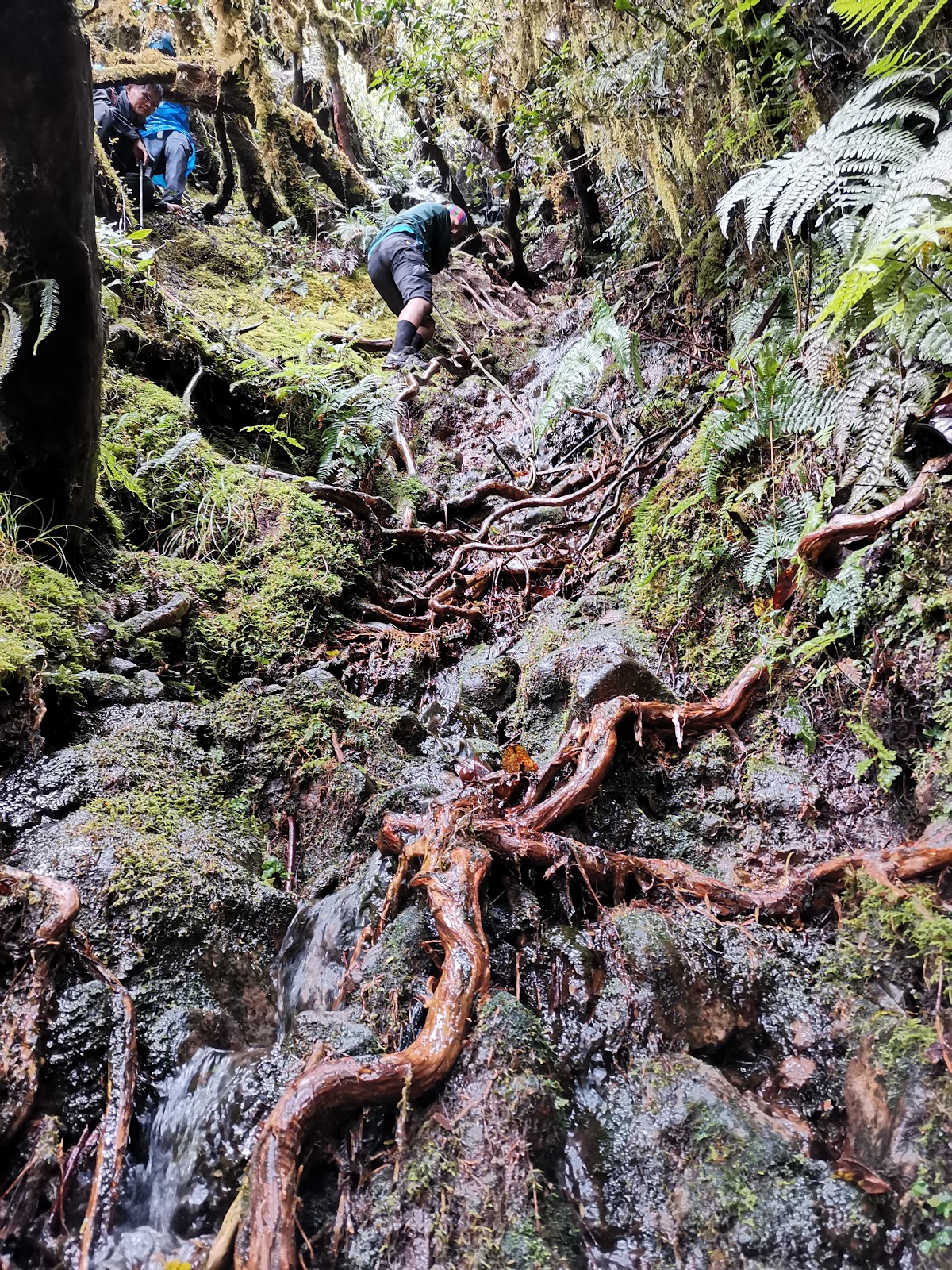
| Slightly muddy with slippery fallen leaves trail |
 |
| View as we started to gain height |
 |
| Voila! View of Peak of Mt. Maagnaw on the open field trail |
 |
| My ever dearest. By and by we'll pass by shaded areas too and here, we took a quick rest. |
 |
| Quick rest. |
 |
| We were able to catch up with the rest of the group who were ahead of us for another brief rest. |
 |
| Pitcher plants! |
 |
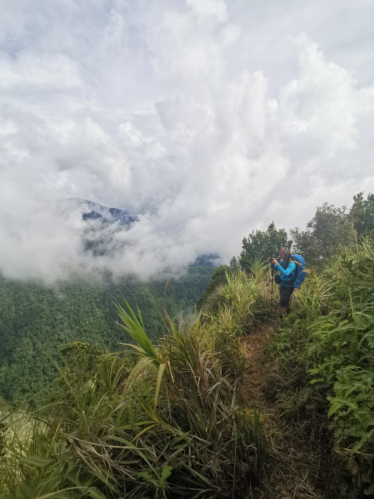
| Parts of the trail give a dangerous view from up above |
 |
| Look at the clouds |
 |
| Another pic along the way |
 |
| So close yet so far. Clearer view of Mt. Maagnaw Peak |
 |
| Arriving at the peak and setting up shelter for the night. |
 |
| Morning picture with the group. |
The descend from the peak of Mt. Kitanglad marked our last day of the climb. The trail along the way has tree-covered parts and open area. There are also metal stairs along the way and still, the never ending slippery rocks. We passed by on one are where there are remnants of land slides in the mountain.
 |
| Hello stairs |
 |
| Cliff along the way |
 |
| Post-landslide area |
 |
| End of hike photo. Reaching the exit point of Mt. Kitanglad. |
Putting yourself in a situation to test how far you can go will make you realize how much your body and mind can handle. I would say we are more resilient than we think we are.Thank you to Challenge the Summit for organizing the event (great food and awesome event organizer Sir Vallant) and to the local guides who were so helpful.
And just to share our expenses (excluding extra expenses for food not included during the climb and room accommodation at Cagayan de Oro for two nights):
Airfare back and forth-
Php 3, 000.00
Event Fee including guide/porter guide fees-
Php 5,000.00
Event shirt-
Php 400.00
Food for the whole climb-
Php 2,500.00
Van from Airport to Cagayan de Oro-
Php 150.00
Bus from Cagayan de Oro to Malaybalay Bukidnon-
Php 150.00
Multicab from Malaybalay Bukidnon to Lantapan Bukidnon-
Php 100.00
Multicab from Kitanglad exit point to highway-
Php 100.00
Bus to Cagayan de Oro-
Php 150.00
Van from Cagayan de Oro to Airport via Lax Shuttle-
Php 199.00
Total: Php 11,649.00


Comments
Post a Comment